
Secrets of the dark earth!


Local Natural Monument
CHÃS DE ARGA PEAT BOGS


GEOSITE
3

Peat also known as turf, is a dark mixture of minerals and dead or partially decomposed plant remains. The amount of organic matter is usually higher to the one existing in most soils.
Peat bogs form when peat accumulates in superficial basins where oxygen-deprived water flows slowly preventing the decay of plant remains. Peat bogs have a distinctive flora, especially some species of mosses, reeds and shrubs.
What do we know about Chã Grande peat bog?
The study of pollens in peat samples reveals the occurrence of climate changes during the last 8000 years. The deepest sample indicates that climate was cooler than today. Shallower samples, which are more recent, suggest changes between cooler and warmer climates. Some of the identified plants indicate the existence of changes in the vegetation as a result of human interference since the Bronze Age.
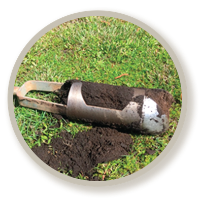
Chã Grande peat sample
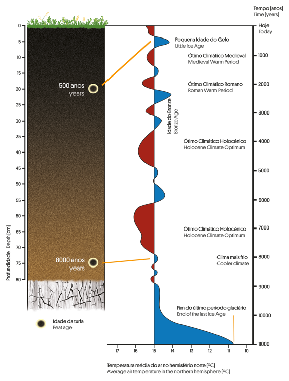

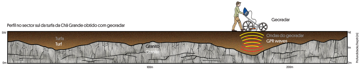
Ground Penetration Radar (GPR) studies assessed the peat bog depth. The thickness of the peat is approximately 1 meter but it can reach 2 meters in some places.
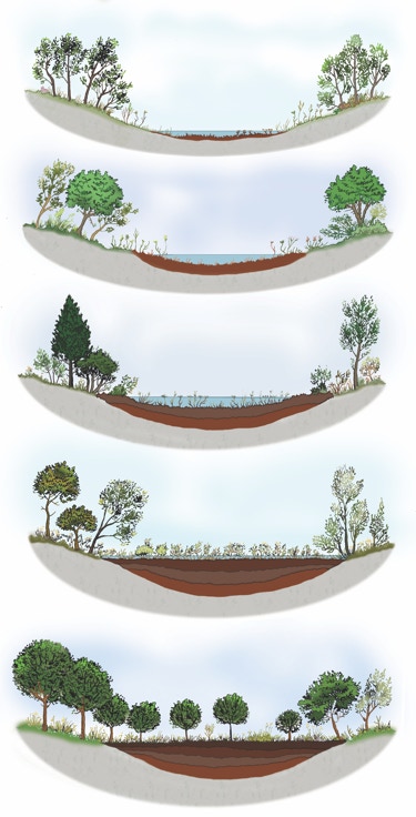
The accumulation of sediments, plants, pollen, spores, and even animals and traces of human activity in peat bogs records the evolution of ecosystems, and provides information about environmental changes during the last 10000 years.

In some countries, peat is used
as fuel for domestic heating.
The only way is up: 800 meters in 80 million years!
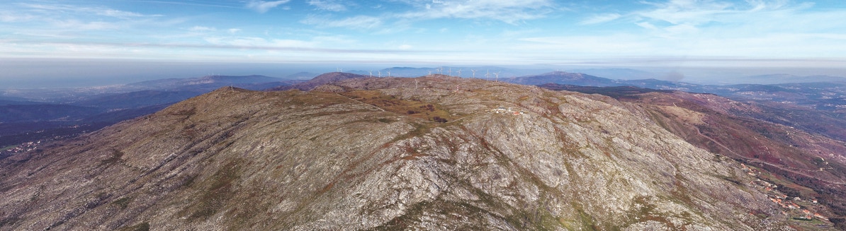
The top of Arga Mountain is a 800 meters high plateau which is 13 km distant from the coast line. This plateau is related to the Iberian Meseta, a flattened surface resulting from the erosion of former mountains that began 280 million years ago. This surface was at sea level 80 million years ago. Since then, it has been raised by tectonics. Today, remains of the Iberian Meseta are still visible in the central part of the Iberian Peninsula and in some other scattered places, like here, in the Serra de Arga plateau.

Can you estimate the average speed of the Arga Mountain raise?
Just have in mind that the Arga Mountain top was at sea level about 80 million years ago, and today the Arga Mountain is 800 meters high.
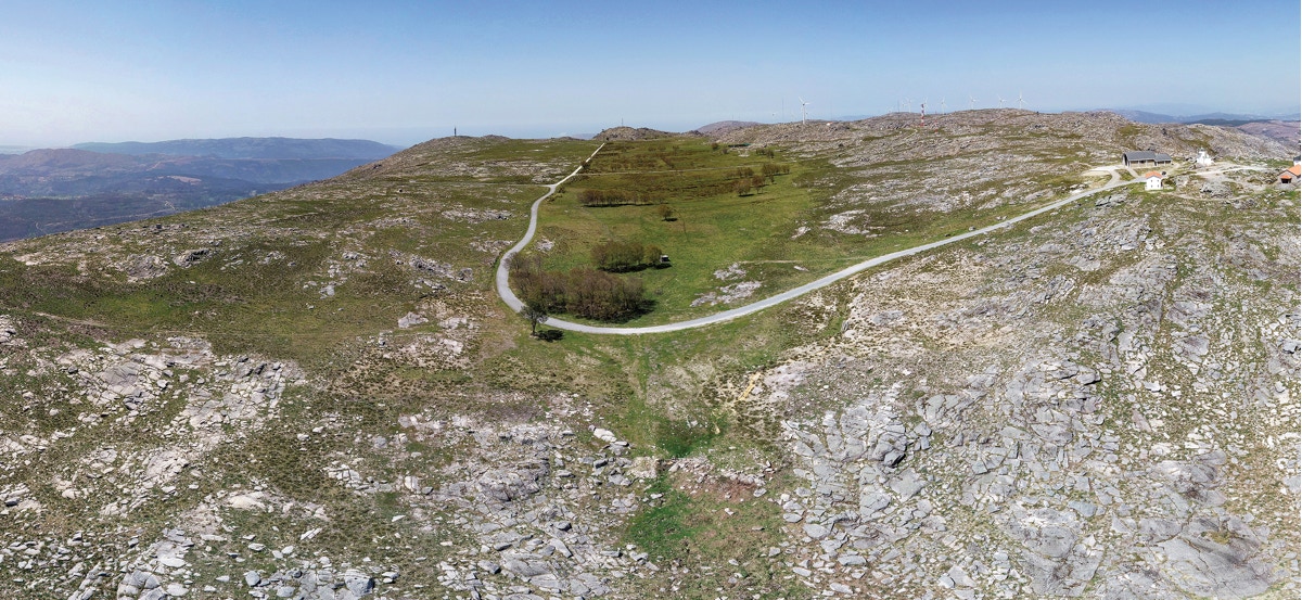
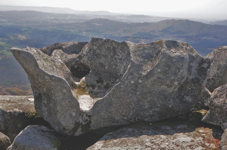
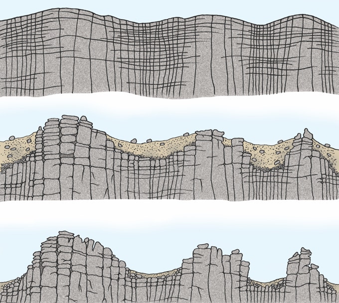
One of the most striking feature of granite landforms at the top of Arga Mountain are the granite slabs detached by horizontal fractures. In the course of time, granite slabs became increasingly detached due to the continuing cycles of water freezing and thawing inside rock fractures.
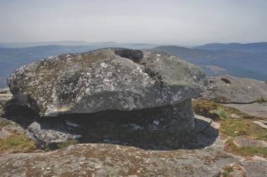
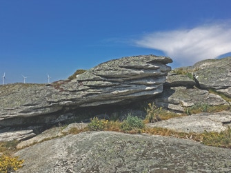
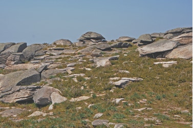
There are several types of granite landforms at the Arga Mountain top. They are the outcome of granite erosion caused by water and wind on the granite. Water reacts with minerals and promotes the break-up of the granite, especially near the fractures. Less fractured areas of the granite become prominent in the landscape giving rise to peculiar landforms such as the granite blocks that can be seen here.
Evolution of granite landforms due to erosion