
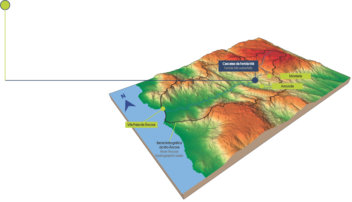
From the source to the mouth


Local Natural Monument
FERIDA MÁ WATERFALLS


GEOSITE
2

This Natural Monument is located in a section of Âncora river. Its source is 805 m high, in Arga Mountain, and it flows into the ocean near Vila Praia de Âncora after a 21 km journey. The Âncora hydrographic basin, with an area of 77 km², lies between the Minho basin to the north and the Lima basin to the south.
Different ways of waterfall formation
Waterfalls are formed when a sudden change in the slope of a riverbed takes place. This change may have different causes (see pictures below). Cascade, cataract, jump, and block, among others, are different types of waterfalls depending on their forms and sizes.
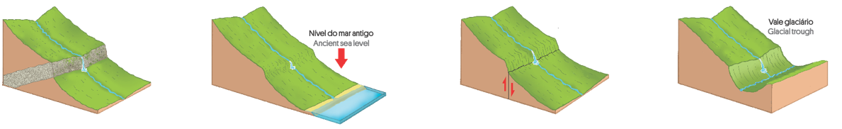
Different resistance of rocks to erosion
Sea level changes
Geological faults
Glacial melting
Ferida Má waterfall is 2.25 km long, between Montaria and Amonde, presents a high slope (7,6%), between 260 and 90 m of high, and is 15 m far from the coastline. Upstream, on the granite western flank of Arga Mountain, the slope is even more pronounced but downstream it becomes quite gentle.
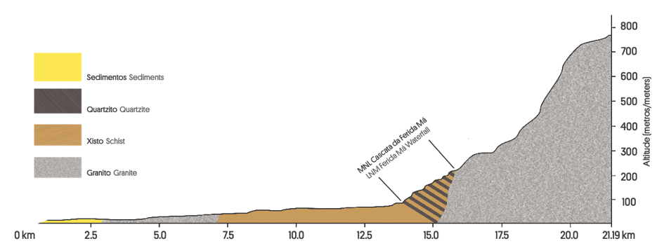
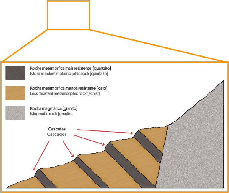
Ferida Má waterfall, also known as Pincho waterfall, is located in Âncora river. The high slope early section of the waterfall is cut into the granite. After, the river crosses dozens of schist and quartzite layers with different resistance to erosion.
The alternation of rocks with different erosional strength gives rise to steps sometimes higher than 5 m.

What type of waterfall
fits Ferida Má?
Âncora river profile and location of Ferida Má waterfall Local Natural Monument
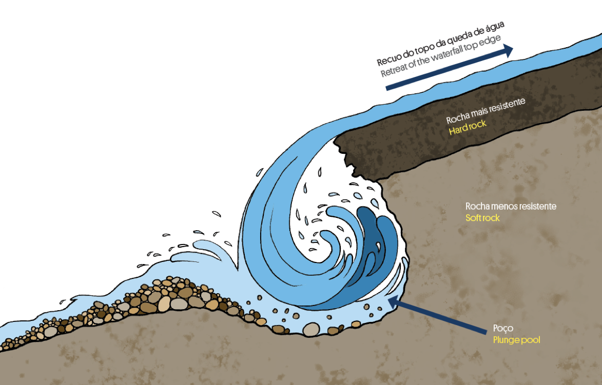
In cascades, erosion acts in particular at the top and bottom of the waterfall. At the top, the erosive action of the running water might lead to a retreat of the waterfall edge and the formation of rapids. At the bottom of the waterfall, the erosion caused by the falling water excavates a plunge pool.
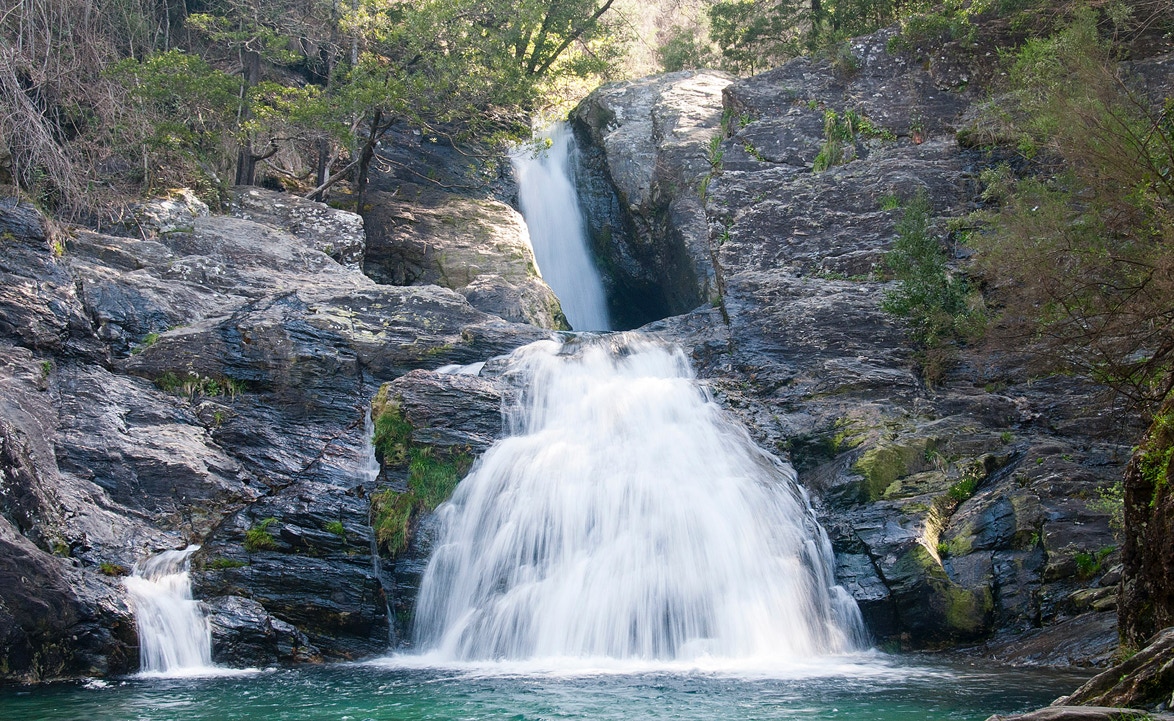
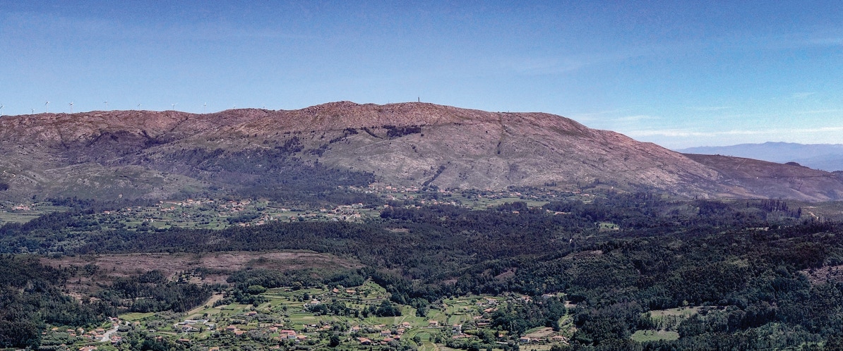
Example of a Ferida Má waterfall (Pincho cascade).